Federal Railroad Administration: Brightline West
Federal environmental-review page for the Las Vegas to Victor Valley high-speed rail corridor.
Open FRA sourceA visual land-banking presentation with public project links, regional anchors, and before/after transformation examples.
This presentation explains the regional growth thesis, highlights public infrastructure and development sources, shows historical land-use transformation examples, and outlines the due-diligence items every buyer should review before choosing a parcel.
Jesse Land Capital presents land banking opportunities through a simple client-first lens: understand the regional growth story, review the public sources, then evaluate the specific parcel with discipline before making a decision.
The land-banking story is rooted in a long Southern California pattern. Professional Land Corporation’s founder message describes how orange groves, flower fields, and walnut groves in areas such as Orange County and the San Fernando Valley transformed into homes, industry, shopping centers, and cities. The same source states that the company group began in 1974 and focused on helping buyers start with their own land parcels through affordable terms.
Our role is to make that story practical for today’s buyer: show the growth anchors, show historical before-and-after examples, and keep the discussion focused on title, access, zoning, utilities, flood, hold period, and resale realism.
Source note: The historical company background is summarized from the Professional Land Corporation About page. Historical examples and regional projects help explain market context, but they do not guarantee the outcome, timing, or resale value of any specific parcel.
The links below point to public project, infrastructure, housing, logistics, and map resources that help frame the regional context. These sources support the market story, but they do not guarantee the outcome of any individual parcel.
Federal environmental-review page for the Las Vegas to Victor Valley high-speed rail corridor.
Open FRA sourceClient-facing project page for the planned high-speed rail system and station story.
Open Brightline WestPublic updates about the rail project’s construction narrative and progress.
Open construction updatesOfficial local logistics airport page supporting the regional jobs, freight, and industrial context.
Open airport sourceIndustrial-development reference for planned warehouse, logistics, and employment capacity.
Open Lake CreekMajor freight and rail logistics project that supports the broader High Desert growth thesis.
Open BNSF projectMaster-planned community reference for long-range housing expansion context in the region.
Open SilverwoodThird-party article supporting the housing-development narrative in the Inland Empire.
Open Builder articleMap review helps evaluate roads, distance, access, nearby development, and surrounding land-use patterns.
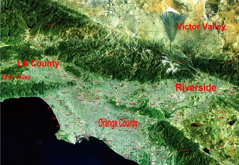
Open Google MapsThese visuals show commercial, retail, hospitality, education, transportation, and logistics context across the broader region. They should be interpreted as regional anchors, not proof that every parcel sits near a specific store, project, or utility line.


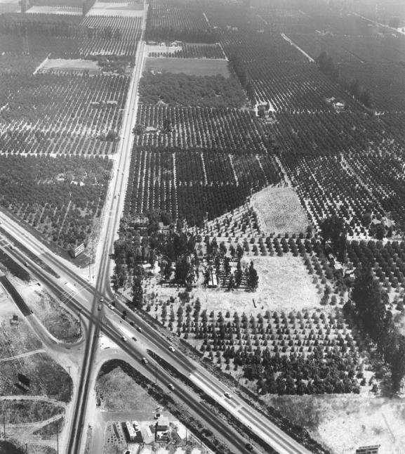
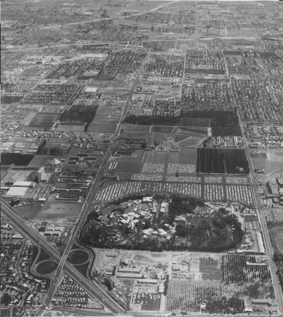
Drag each slider to compare historical “before” and “after” visuals. These examples illustrate how land can change when demand, access, utilities, employment, and capital converge. They are examples only, not a promise of appreciation or development approval.
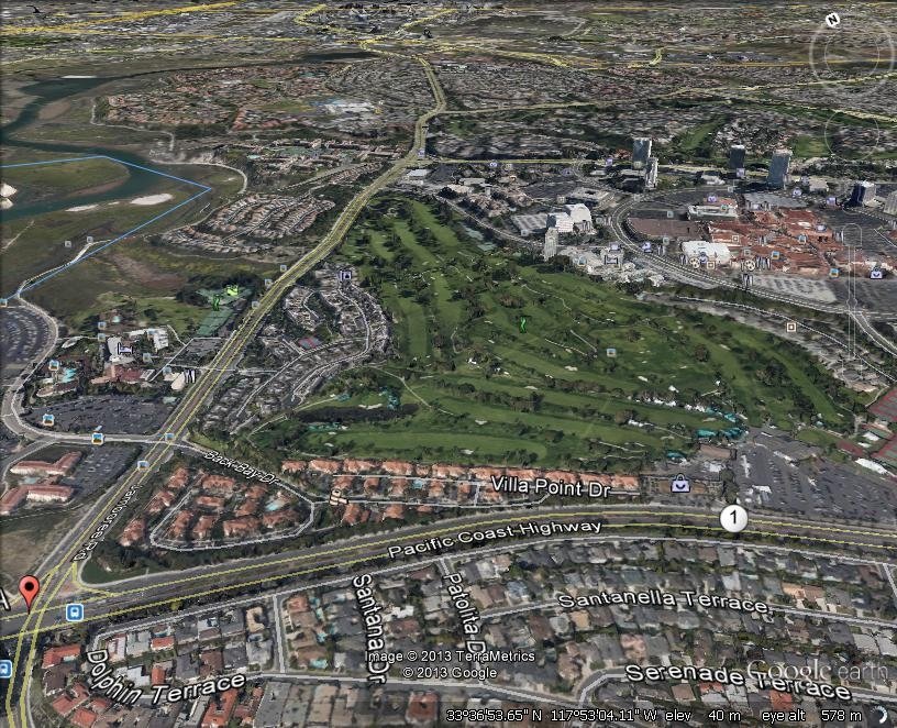
Historical aerial comparison showing how open or lightly used land can shift into denser urban and commercial development over time.
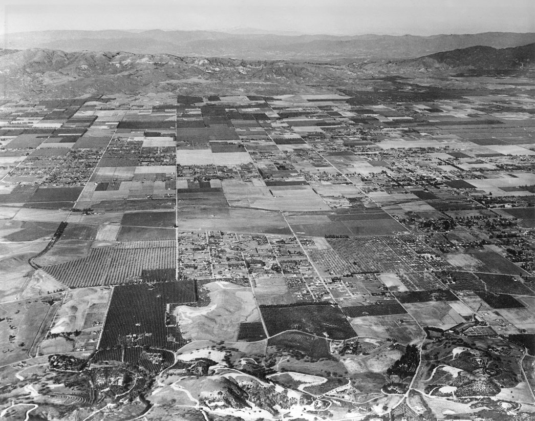
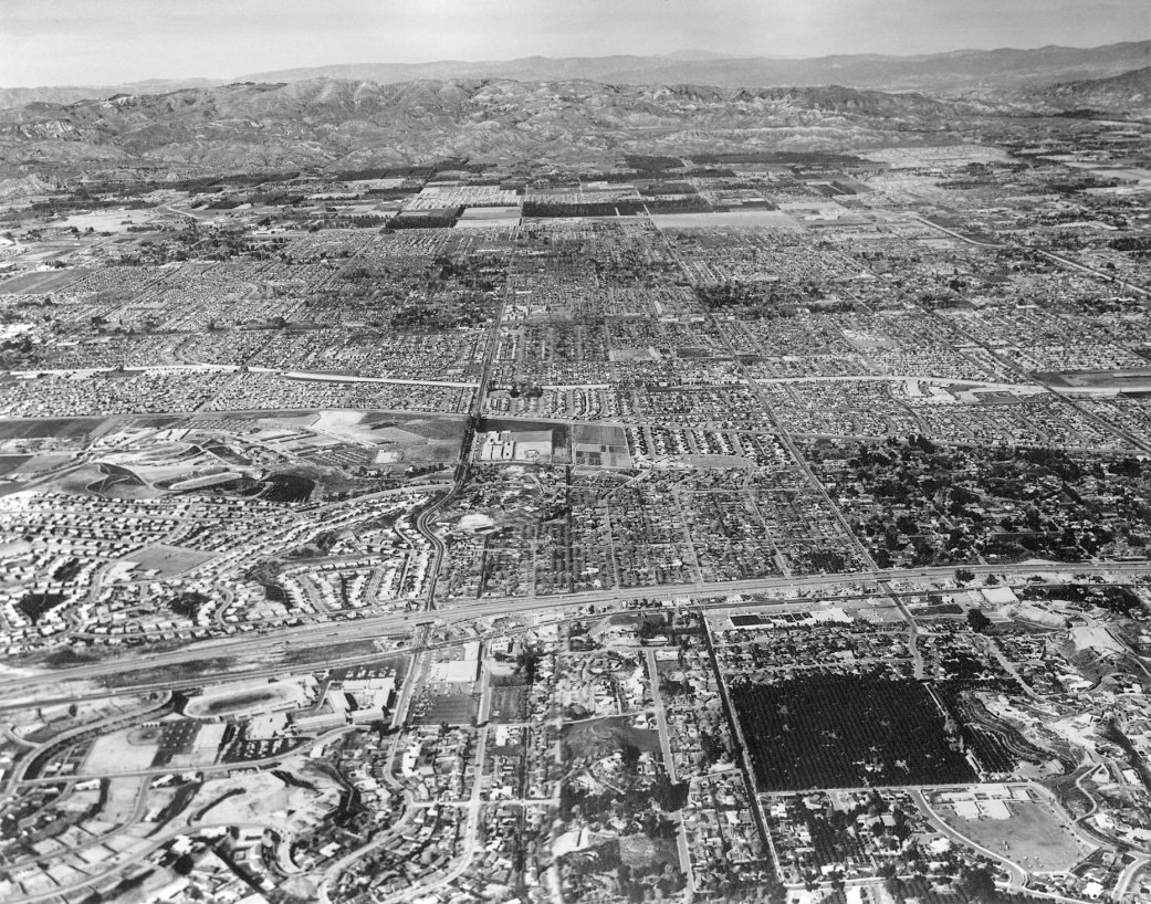
A long-term suburbanization example that helps clients understand why patience, location discipline, and infrastructure matter.
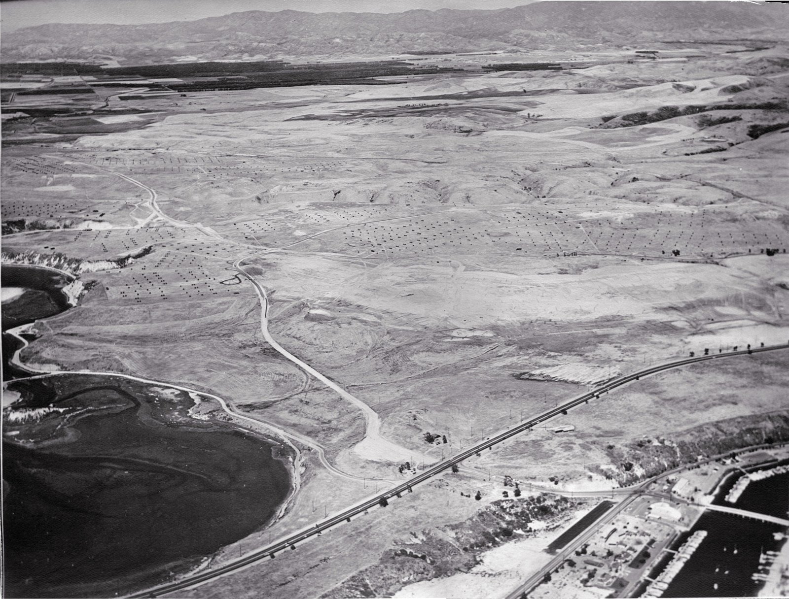
Undeveloped-to-developed contrast used to explain the core land-banking thesis: buy where future utility may arrive.
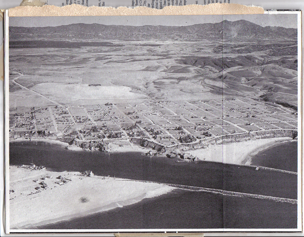
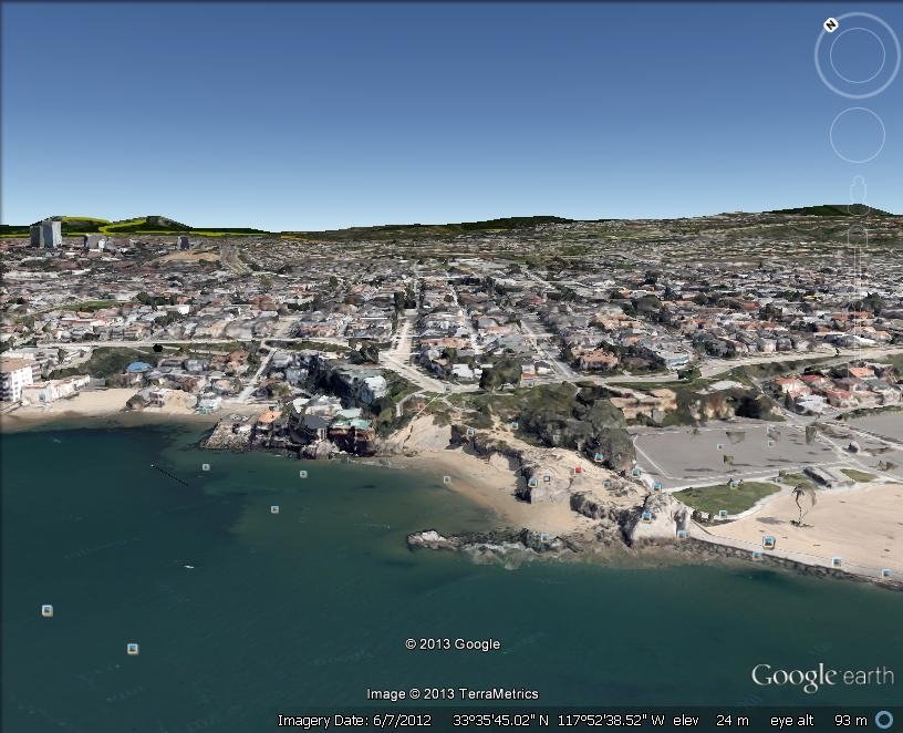
A coastal-development before/after visual that reinforces the importance of long-term land-use change and location scarcity.
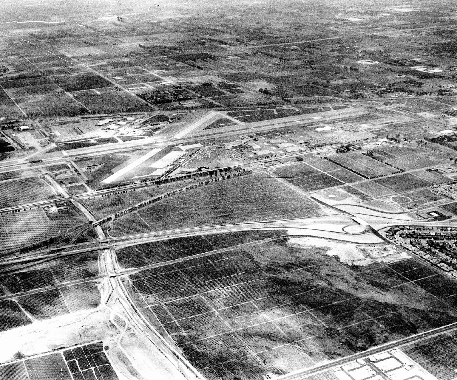
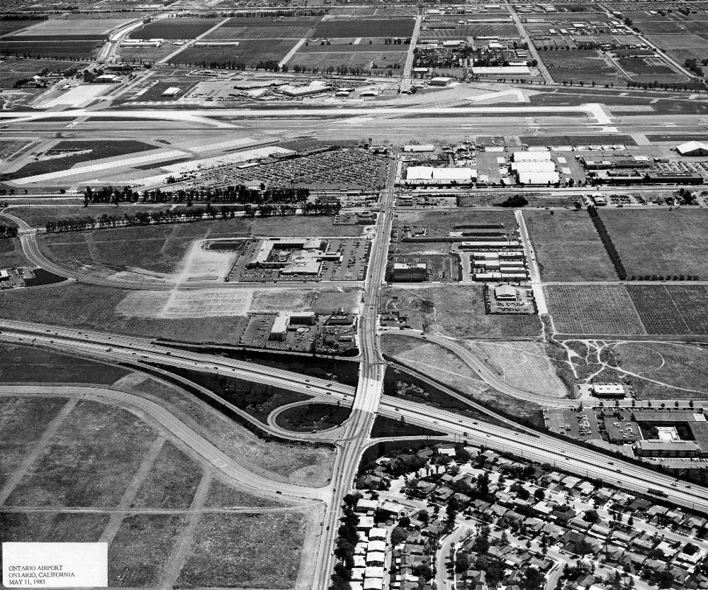
Airport-area transformation example for discussing transportation, employment nodes, and surrounding development.
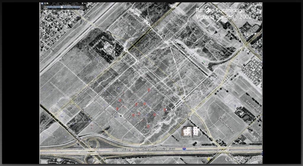
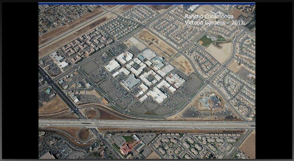
The cleanest side-by-side story for industrial corridor conversion from the source deck.
A strong land purchase decision should connect the big-picture growth story to the exact parcel being considered. The sections below organize the opportunity into a clear buyer review path.
Infrastructure, housing, logistics, and employment anchors create the broader market context for land-banking opportunities.
Rail, logistics, housing, industrial, and map resources provide transparent references behind the regional story.
Historical transformation visuals help illustrate how land-use patterns can change over long time horizons.
Road access, nearby development, distance to anchors, terrain, and surrounding land use determine whether the story applies to a specific parcel.
Title, legal access, zoning, drainage, utilities, taxes, pricing, and hold period should be reviewed before moving forward.
The next step is a parcel-specific review, written summary, available inventory discussion, and document request.
The regional story is only the starting point. A buyer should evaluate the actual parcel, documents, access, zoning, utilities, terrain, title condition, pricing, and realistic holding timeline before making a decision.
Confirm seller authority, vesting, taxes, liens, and recorded documents.
Review ingress/egress, recorded easements, landlocked risk, and practical road access.
Check current zoning, overlays, build limits, nearby power, water, sewer, and realistic improvement costs.
Look for washes, slope, flood exposure, grading concerns, and buildability issues.
Review the parcel location, available documents, purchase terms, access, zoning, taxes, and holding strategy before deciding whether the opportunity fits your goals.
Disclosure: This presentation is for general informational purposes only. Regional projects, company presence, before/after examples, maps, and source links do not guarantee appreciation, resale timing, zoning changes, utility access, development approval, or liquidity for any specific parcel.